
If you find yourself California dreamin’ and dreaming to get unplugged and immersed into nature, the California Lost Coast Trail is for you!

Pristine and left wild for wild’s sake, Northern California’s Lost Coast Trail is the longest stretch of undeveloped Pacific Ocean coastline in the United States (outside of Alaska). When State Route 1, California’s Pacific Coast Highway, was engineered, surveyors decided to turn inland 30 miles for the 80-mile stretch of the Lost Coast to connect Highway 1 to US 101, avoiding the rugged, dangerous ridge along the King Mountain range where steep cliffs drop to the sea. Today, the stunning coastline is on the top of many backpackers’ must-do destinations, a rare opportunity to relish the California surf and scenery without development, tourism, or crowds.

In the 1970s, the U.S. Congress made the mountainous King Range a National Conservation Area, administered by the Bureau of Land Management that keeps it protected by limiting the number of permits and containing the human footprint. The most-trekked part of the trail is the flat northern 26-mile route between Shelter Cove and Mattole Beach, with the less-trekked southern part from Needle Rock to Usal Beach going up and down every ridge and touching every stream and creek.

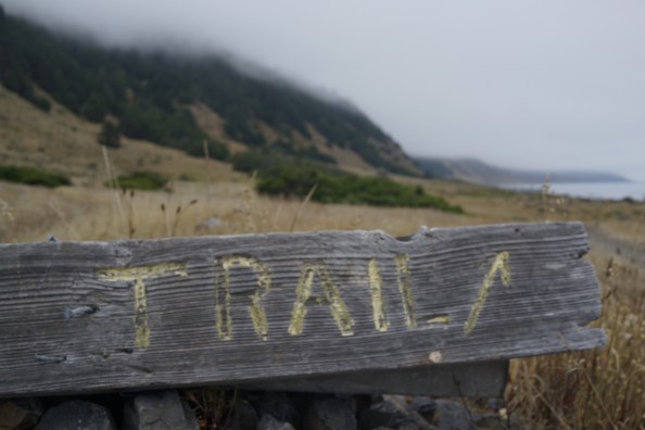
What makes this hike particularly unique is its inaccessibility. Even today, the roads getting to the trailheads are steep, bumpy, and winding. And it takes planning. Come prepared by arranging for a shuttle driver, an updated tide chart, and an official trail map. I read about trail details and noticed photos of the various unmarked turning points in the trail. With these, you shouldn’t get lost or swept out to sea.
From San Francisco drive north up US 101 towards Humboldt County to Garberville, a small town of 1000 people, more or less, that serves as a gateway to Humboldt County. Here is the turn off point from US 101 onto a 24-mile, twisty-turny drive to Shelter Cove, an isolated seaside community with a population of around 700 that divides the 52 miles of the Lost Coast trail.
We met our driver in Shelter Cove to shuttle us to Mattole Trailhead where we began our north to south hike. Driving the twisty, bumpy, narrow, partially paved road to the Mattole Trailhead was, in my mind, the most treacherous part of the entire backpacking trip. Bucking along the route we tuned in to Reggae on the River live broadcast, which was a suitable mood setting soundtrack to the start our journey.
We began our 26-mile walk along the beach at 5:45 PM. We headed to the Punto Gordo lighthouse, a three-and-a-half-mile hike along the beach. We passed only one other camper, who had set his tent up far off the beach about a mile into the trail. We arrived with ample time to linger before sunset.
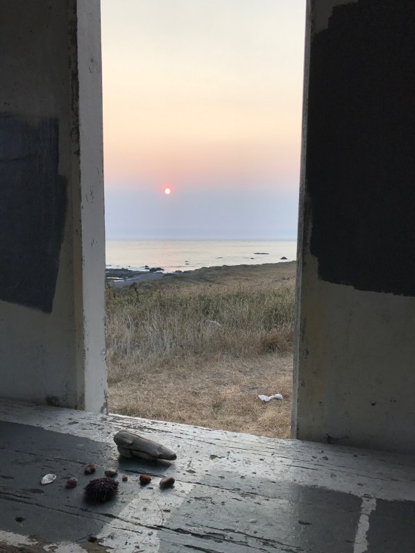


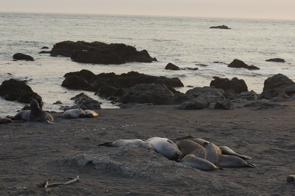
After pitching our tent on a soft trampled patch of sea grass directly in front of the lighthouse, we sauntered down to the beach and sat on a log watching a group of sea lions and harbor seals chest bumping, claiming their cozy spots on the sand for a night of rest. A fresh marine fog rose from the sea, which dispersed the heat and brightness and provided for a cool, soft sunset. We watched the distant light fade into the veil of thin fog as we sat on a ledge at the abandoned lighthouse. The only beings we shared the lingering sun with were the barking sea lions and playful harbor seals. One seal slithered up the sand bank to keep watch on us through the night.

We planned for our hike during the full sturgeon moon. Past the midnight hour of our first night, I shimmied out of the tent to gaze at the full orb, which cast a dreamy, diffused light through the thin misty air where I could slightly make out the shapes of rocks (or were they sea lions?) on the beach and the silhouette of the mountain range.

In the morning, we were greeted with bright headlamps dancing about. A group of early risers camped near the trial head who had gotten an early start, woke us as they were exploring the lighthouse, reminding us it was time to begin our fourteen-mile trek from the lighthouse to Miller Flat Creek. The unmarked trail from time to time turned off the beach and meandered up onto grassland meadows and passes by a few cabins, one completely abandoned and left to the fate of the elements and another two that looked habitable–one even had a grassy airstrip. We saw only a dozen (or so) hikers, and everyone kindly respected the quietude that each of us came to experience, allowing each other space and seclusion and a sense of solitude. Even on Big Flat beach, where north bound hikers coming from Shelter Cove meet south bound trekkers from Mattole trailhead congregate to camp for a night. We arrived too late to nab one of the few coveted hiker-built driftwood shelters, although, we found a perfect spot to pitch our tent at the southern end of the Big Flat beach next to Miller Flat Creek. A perfect spot, near the fresh water, close enough to hear the sound of the waves, shaded by a scrubby tree, and with plenty of driftwood for makeshift tables and seats to sit with a book or staring out at the vast open horizon where the sea meets the sky.
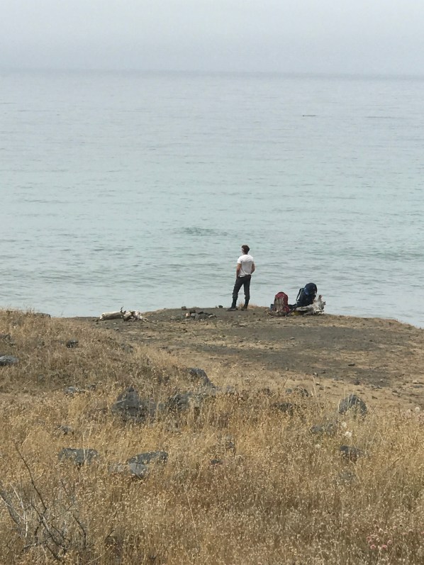

Before sunset, two surfers walked into camp. That’s tough, I thought, carrying a pack and a surfboard on one’s back while navigating footing on the squishy sand and uneven roly-poly rocks. They reminded me of those adventure seekers who carry their skis on their backs up to Camp Muir on Mt. Rainier and then ski down the glacier. While the skiing or the surf might be better somewhere easier to access, it is the entire adventure that makes it perfect; and, the nine-mile hike in from Shelter Cove to Big Flat is a favorite amongst surfers. Later that evening watching them surf my admiration for them increased, not only did they haul their gear in, but they paddled out and surfed for over an hour in the cold northern California Pacific Ocean; and, they had no fire (because fires are prohibited) to warm up with once they got out of the water!


During the night, we shared the same rhythmic sounds of the rising and retreating waves, with the other backpackers and a few wild creatures. A skunk came out of the bushes and walked into our camping spot sniffing around as we were settling into our tent for the night. We both sat still as the logs, frightened as much as if a bear had walked into our campsite. I woke in the moonless black night and wandered towards the sound of the breaking waves with my headlamp guiding me. The fog was thick. I saw dozens of glowing eyes staring at me. I focused my light to see whom I had startled and who startled me–there was a family of river otters observing me, and as surprised as I was to see them.

The next morning as the sun pushed through the dense morning fog, I noticed we were following fresh bear tracks in the sand. Based on the tides, that bear could not have been more than 45 minutes ahead of us. A part of me was excited to see a bear, and I kept stopping and looking forwards and back, up and down the beach, and up the tree-lined rocky cliffs and towards the distant meadow, although I never saw the bear, I know it was near!

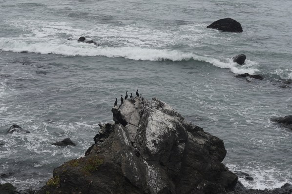
Walking along the shoreline, the constant and harmonious roar of the ocean becomes a soundtrack to drifting thoughts. In the infrequent places where the trail winds onto the sedges and rushes (a welcome respite from walking on shifting sand and slippery rocks), there is enough distance away from the waves to hear a few of the nearly 300 species of native and migratory birds that inhabit the Lost Coast Trail. Another migratory species, the grey whale, travels along this coastline; if timely planned you may be fortunate to spy these majestic creatures offshore during your long walk on the beach.

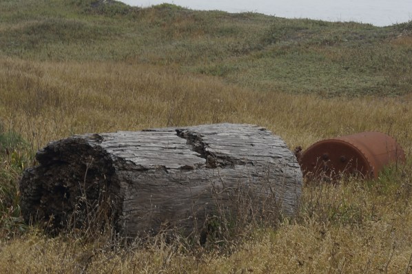
We passed by the appropriately named Seal Rock, a craggy, speckled island crowded with harbor seals. We saw Sea Lion Gulch where many rotund sea lions slumber on the sandy shore. We passed by a decaying carcass of an 80-foot long blue whale. Before the tides rose, we strolled by tide pools with colorful starfish and sea anemones. I noticed the trail was litter-free. I felt a sense of gratitude toward those who hiked the Lost Coast Trail who shared a desire to keep it pristine and leave no trace, not even their footprints.

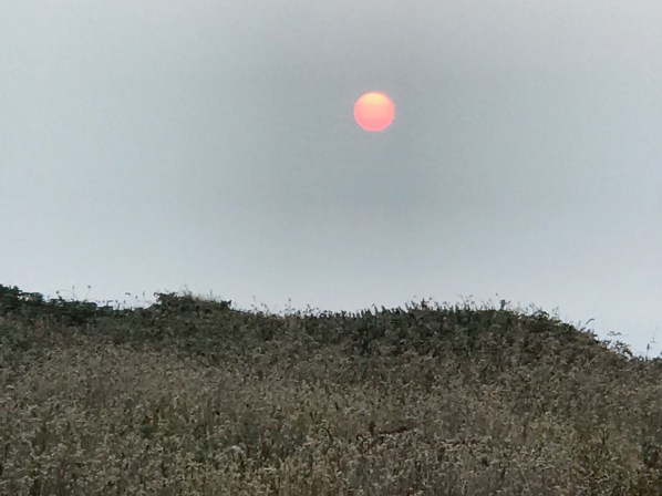
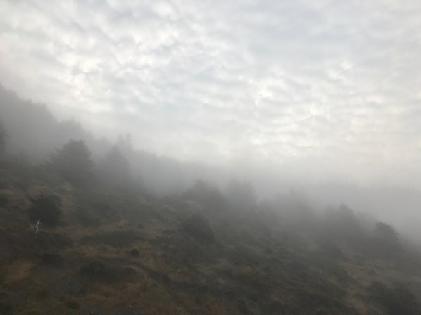
The four and half mile stretch towards Shelter Cove rambled along a narrow beach, lined by a rocky cliff-hugging shoreline where the 4000-foot King Range rise steeply from the rocky black sand beach. This is said to be the most difficult section of the trail. With even a three-foot tide it is not possible to pass, because the waves would cover the beach and crash into the cliff. The morning light shifted from various shades of gray as the sun tried to filter through the damp, foggy sky creating an indiscernible veil of distant light. As we were hiking, the beach would disappear into the mist giving a feeling of walking into infinity.
Mile upon mile of the 26 miles, taking in the serene ocean view, the experience threw a new light on strolling along the beach. In the end, it is not one of the most difficult hikes I have done; indeed, it had its moments of feeling arduous yet not the adrenal rush of climbing high altitudes or the extreme challenge of Rocky Mountain ridges. We considered, our 42 hours on the trail could possibly be completed in one day, factoring in the tides and with proper planning, and a headlamp—now that would be challenging, but it could be done. Going slow is usually not my pace, but the Lost Coast induces slowing down. Much of the reason for going on this hike is to unplug far off the path of cars, campers, and crowds: this is why most hikers take three to five nights to savor the views and tranquility and experience the splendor of the foggy, misty sky and falling asleep with the ocean singing a lullaby, a continual harmonious ebb and flow of rolling waves.

